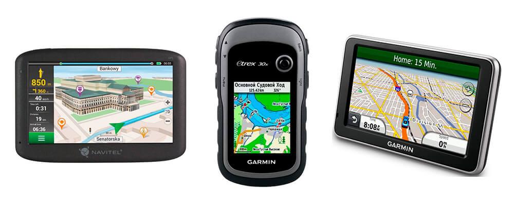
If you are fond of hunting or long walks in the forest, then you definitely noticed that the phone cannot provide all the necessary information. Firstly, far from civilization, only offline maps with a low level of detail work. Secondly, high-quality topographic maps have not yet been invented for smartphones, and on ordinary ones you rarely see ponds, small streams, and even lakes.
Needless to say, such maps even display information about trees growing in the forest you plan to go to. In general, travel navigators were not invented in vain. They are equipped with topographic maps that help tourists, hunters and fishermen to better navigate. We have tried to identify the best navigator for the forest in 2020.
Content
Rating of GPS navigators
According to experts and consumers, such models can be considered the best.
Garmin GPSMAP 64st
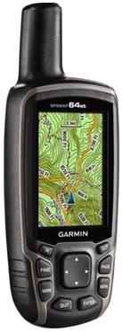
The model can be confused with a walkie-talkie due to the external antenna protruding from the top end. This negatively affects the versatility of the device, since it complicates placement on a car torpedo. Another disadvantage is the lack of a touch panel, so it is very inconvenient to use the navigator while the car is moving. Some users argue that the device is intended for use by tourists only and not for motorists and cyclists.
The picture is displayed on a 2.6-inch display with a resolution of 160 * 240. But this is quite enough to see even the smallest marks on the map. In addition to the map, the product has a fishing and hunting calendar.
You can upload different maps to your device, even raster maps. To download them, there is 8 GB of internal memory. Most of the memory is already occupied by proprietary topographic maps. If you don't want to delete them and upload new ones, then you need to install a microSD flash drive, for which a special slot is provided.
With the purchase of a Garmin GPSMAP 64st, you can use the BirdsEye service for free for a year. With it, you can view satellite images of the surrounding area.
The navigator composes the route competently, there is a Track-Back function. The work with satellites is stable, the device interacts with GPS and GLONASS. There is no connector for an external antenna, but it is not really needed either.
The model is equipped with a barometer and a magnetic compass, which greatly simplifies navigation, supports ANT + technology (you can easily do without it). The device works offline for almost 16 hours. Rechargeable from batteries and accumulators. The navigator can be used with lithium batteries, only for this you need to specify a suitable power source in the settings.
The list of shortcomings is presented:
- high cost;
- weak display resolution;
- problematic operation due to the antenna.
Garmin eTrex 20x
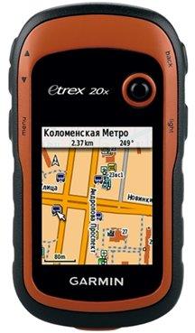
When deciding which navigator is best for the forest, it would be unforgivable to ignore this model. It is considered one of the cheapest, but of high quality. It has an average functionality. Unlike other devices in our rating, the Garmin eTrex 20x will not determine the altitude at which you will be located. An external antenna connector is not provided. The built-in memory is small - only 3.7 GB, but there is a slot for a memory card.
You need to control the device using tight buttons located on the sides and a joystick located above the screen.If you do not lock the keyboard and put the navigator in your pocket or backpack, it will be able to perform arbitrary actions on its own. This will not lead to irreversible consequences - just a few additional waypoints will appear on your route.
The device can store 200 routes. Waypoints are also stored in sufficient quantity. The speed of route calculation depends on its distance, but in general it happens quickly. There is an audible alarm and a standard Track-Back mode.
The display quality is decent: the diagonal is 2.2 inches, the resolution is 240 * 320. Such a screen was previously installed on Nokia N95 and Nokia E65. There is an internal antenna, so it is quite difficult to break the navigator. High quality water resistance and resistance to mechanical damage or falling. For navigation, data from American and Russian satellites are used.
The model runs on 2 batteries or AA rechargeable battery, but it is impossible to recharge them directly in it. The device can work continuously for up to 25 hours.
The navigator is appreciated for:
- availability of additional applications;
- light weight and compact size;
- the ability to use a memory card;
- good autonomy;
- the presence of sound alarm and vibration signal;
- affordable price.
Minuses:
- controversial display quality;
- lack of wireless modules;
- to charge the battery, it must be removed from the navigator.
Garmin GPSMAP 78
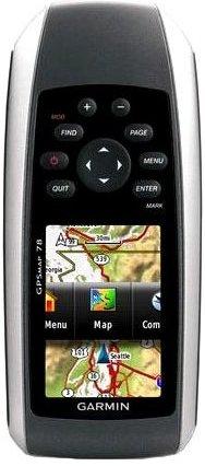
A navigator with an unusual appearance: the display is located under the buttons, so you will get used to it for a while. Some users have complaints about the technical characteristics. Firstly, the memory capacity is only 1.7 GB, which does not allow loading the required number of maps. The situation is saved by the ability to use a microSD memory card. The second controversial point is the relatively low resolution of the LCD. On a screen with a diagonal of 2.6, only 160 * 240 pixels - a progressive user will definitely not be pleased with it.
The device can store no more than 200 routes, which is quite acceptable. The capacity of the travel log is designed for 10,000 points, which is also pleasantly pleasing. The navigator plots the route of movement independently. It is equipped with an internal antenna that communicates easily with GPS satellites. The device was created before the popularization of GLONASS, therefore it does not support these satellites.
The navigator has reliable moisture protection, so even if it falls into a pond or puddle, nothing will happen to it. The case itself is rather weak, so it can break if dropped on stones or asphalt.
The device works on two AA batteries. If the screen backlight is turned on only when necessary, the autonomy will last for almost 20 hours. If you are going out of town for a few days, bring a few pairs of AA batteries.
Minuses:
- inconvenient location of buttons;
- small amount of memory;
- does not interact with GLONASS;
- the battery cannot be charged directly in the device;
- raster maps are not well supported.
Garmin Montana 680
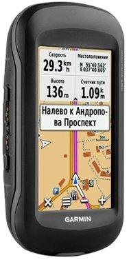
It is considered one of the most advanced GPS navigators for forest orientation. Some users call it universal. It attaches easily to your car dashboard. Equipped with a 4 '' display with touch backing, so it is easy to operate even in extreme conditions.
There are voice prompts here, so you definitely won't miss a turn. If you are going to the forest, the device can be mounted on a bicycle handlebar. As a result, you have a reliable cycling computer. It can be paired with heart rate and cadence sensors as it supports ANT + wireless technology.
If we consider the device only as a tourist navigator, then there are practically no drawbacks in it. Sold with topographic maps already installed, but others can be downloaded if needed. The main memory is 8 GB, but it can be expanded with a microSD memory card. The device can store 200 routes with 4,000 waypoints each.It is impossible to get lost with the navigator - if you feel that something is amiss, activate the Track-Back option, and the device will show you the way back. It is good news to have a digital compass and barometer, which make it easier to navigate in unfamiliar terrain.
The model is sold with a lithium-ion battery that provides 16 hours of continuous use. To charge the battery, it is not necessary to remove it from the navigator - just insert a couple of AA batteries.
As with any travel GPS navigator, the case is waterproof. There is no connector for an external antenna, but hurry up to be upset - the device receives all signals well even without it.
On the front side of the device there is a color screen with a resolution of 272 * 480. Of course, when compared with a phone, this figure seems weak, but in reality it is completely enough.
Only drawback models - high price.
Garmin Fenix 3 Sapphire HR
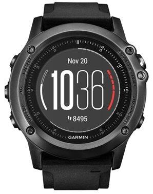
Most likely, you did not expect to see smartwatches in our rating. But this device does an excellent job with the functions of a GPS navigator for the forest. Your movement will be accompanied by voice prompts, so the probability of getting lost is minimal. The device works great with American and foreign satellites. You can save jogging and walking routes on it. Thanks to the built-in heart rate monitor, the watch will record your heart rate. Additionally, there is a digital compass and altimeter, support for ANT + technology, which allows you to connect external sensors to the watch.
The device, like any navigator for the forest, is not afraid of moisture. There is a waterproof rating of the WR100 standard, so even swimming in the river will not harm it.
Information is displayed on a 1.2-inch round display with a resolution of 218 * 218. The picture is clearly visible even in bright sunlight. The front panel is covered with a sapphire crystal, which is resistant to various scratches. There is a hole for the speaker.
32 GB of memory is given to store information. You cannot install a memory card, all additional applications are loaded onto the memory of the smartphone connected to the navigator. It's not very practical, but you can get used to it.
The gadget can work in multisport operating mode or as a metronome.
Unfortunately, the battery autonomy is rather weak, but it is well optimized, so a full battery lasts for almost 20 hours of active work, and with GPS off, the autonomy is even greater. According to some users, this smartwatch is the best forest navigator for Android.
Minuses:
- very expensive;
- there is no NFC chip;
- additional maps can only be downloaded to a smartphone;
- charged only from the power bank.
Magellan Triton 500
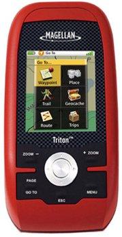
Suitable for those who are just starting to get involved in walks in the forest. The product calculates short routes well. The case is waterproof, so you can use the navigator even in a rainstorm.
The product is equipped with TrueFix technology, which indicates your location very precisely. You can create maps manually or upload ready-made ones.
Advantages:
- shockproof housing;
- compatible with MapSend software;
- maps are created using Mobile Mapper Office;
- you can use a USB flash drive;
- the presence of a barometric altimeter;
- affordable price - 10,000 rubles.
The disadvantages include only GPS support and weak autonomy - only 18 hours.